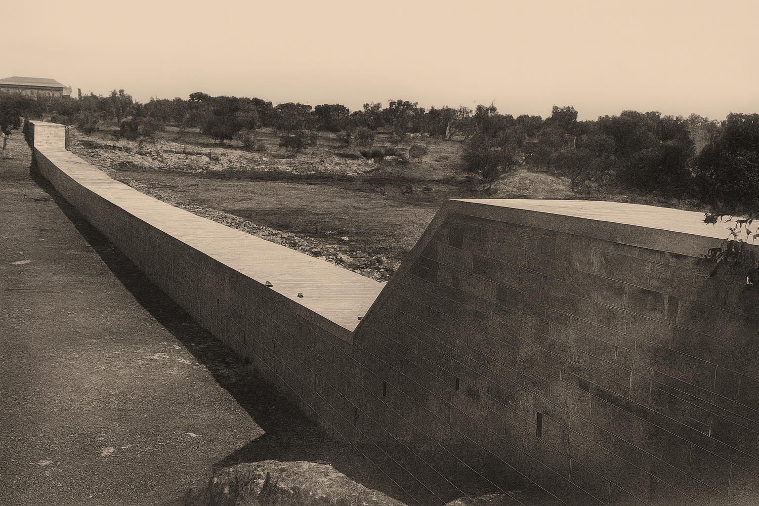
The Picone ravine embankment damaged by the flood
Gazzetta di Puglia, martedì 9 novembre 1926, p. 3
Acknowledgement: Roberta Ranieri, Università di Bari Aldo Moro, per aver segnalato la foto.

SOUTH RISK
From data collection to monitoring intervention. A southern history
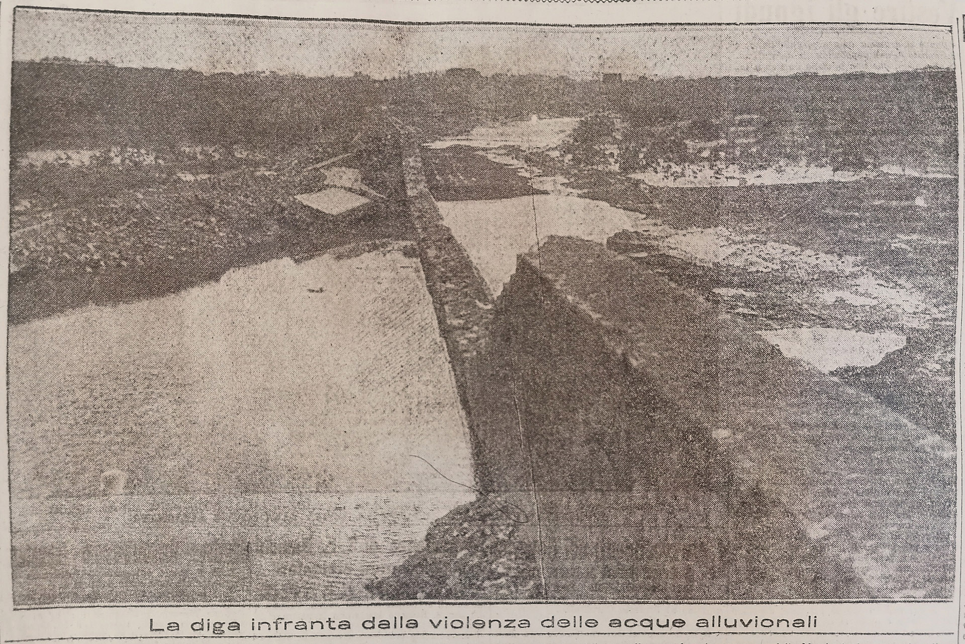
Gazzetta di Puglia, martedì 9 novembre 1926, p. 3
Acknowledgement: Roberta Ranieri, Università di Bari Aldo Moro, per aver segnalato la foto.
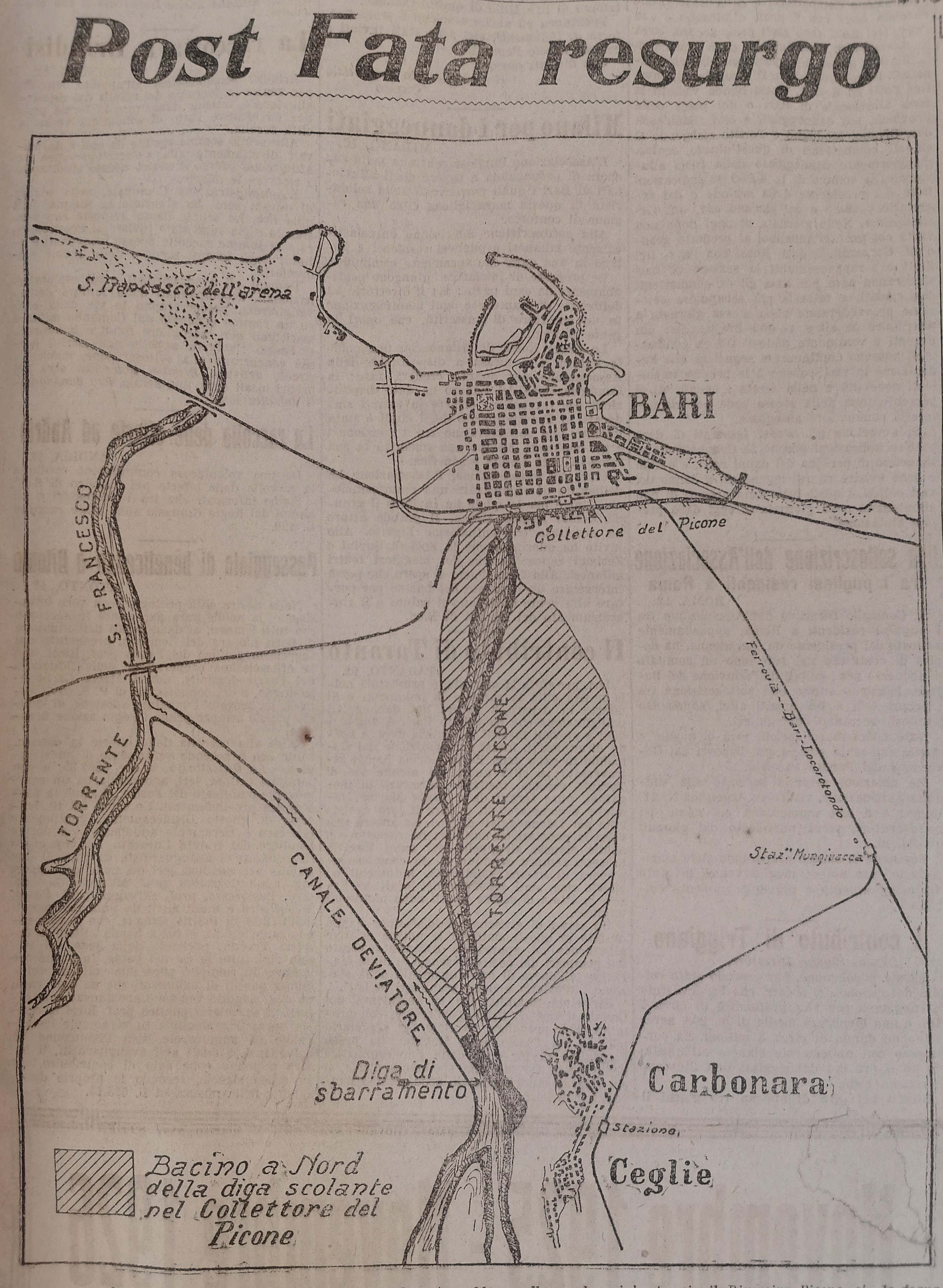
L’argine spezzato. Lama Picone e la città di carta
Technically speaking, Lama Picone is not a river. Like all the lame – the dry ravines that cut
through the Bari basin –
it is a groove carved by time: usually parched, yet ready to turn into a torrent whenever,
especially in autumn, the sky
bruises and rain becomes relentless. It was no coincidence that the French historian Fernand
Braudel once described the
Mediterranean climate as a “two-stroke engine (motore a due tempi)”: months of absolute drought
followed, all of a
sudden, by floods that tear through the soil and sweep everything away. The photograph of the
collapsed embankment in
1926 captures the instant when that fragile boundary between city and nature finally gave
way.
And yet the lame were not
invisible to the law. As early as the Decreto Regio of 1865, and again in 1904, they had been
recognised as public
waterways, subject to hydraulic regulation and oversight. But, as often happens, legislation
proved powerless against
the fever of construction. By the end of the nineteenth century, the Libertà district had spread
dangerously close to
Lama Picone: rows of workers’ houses, narrow streets, poor sanitation. It was an expansion that
ignored the warnings of
the Corps of Civil Engineers (Genio Civile) and the High Council of Public Works (Consiglio
Superiore dei Lavori
Pubblici), which in 1867 had already urged the city to correct water drainage and reclaim the
Marisabella marsh, on
whose edge the new neighbourhood was rising.
So when Picone’s embankment collapsed, the
flood struck a quarter that was
already vulnerable – built, quite literally, inside a riverbed the city had chosen to forget.
The lama, once silent,
began to roar again. In the aftermath, even the engineers could not agree on the cause. Pio
Alberto Nencha spoke of a
foretold catastrophe: if the flood “did not cause the same damage as that of 1915, it was only
because the settlement
had not yet invaded, as it does today, the bed of the torrent (non produsse i danni di
quest’ultima [scil. verificatasi
nel 1915] fu perché l’abitato non aveva ancora invaso, come oggi, il letto del torrente).”
Gaetano Valente, more
indulgent, described it instead as a «sleeping stream (torrente addormentato)», erased from
collective memory. Two
opposing views, revealing more of the political hesitation than of the hydrological truth.
After the disaster came the
grand works: the widening of Lama Picone by over thirty metres, the diversion of nearby Lama
Lamasinata further west,
the channelling of other watercourses deemed dangerous. Vast, costly measures – yet all too
late. They treated the
symptoms, not the disease: an urban growth too chaotic to respect the land’s own geology.
The collapse of the Picone
embankment in November 1926 thus remains the emblem of a deeper rupture: between a city growing
too quickly and the
natural landscape that no technical illusion could ever erase.
___Stefano Daniele &
Francesco Paolo de Ceglia
References
From data collection to monitoring
interventions and
risk prevention
Project realized by:
University of Bari Aldo Moro
INAF - Astronomical Observatory of Capodimonte
University of Naples Federico II
University of Messina
PROGETTO SOUTH RISK © 2026 ALL
RIGHTS
RESERVED
The exhibition is realized for the project:prin
pnrr
South-Risk
From data collection to monitoring
interventions
and
risk prevention
A southern history
P2022TA5M8