Forecasting the sea during storms: the case of Storm Ines
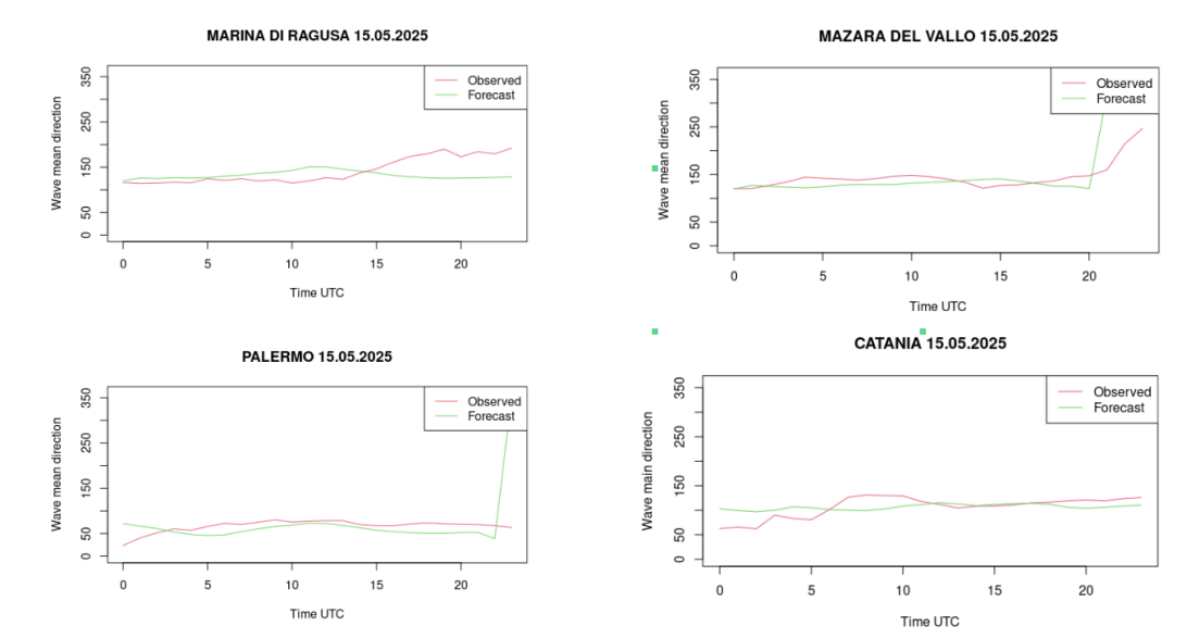
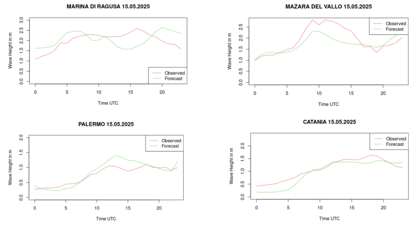
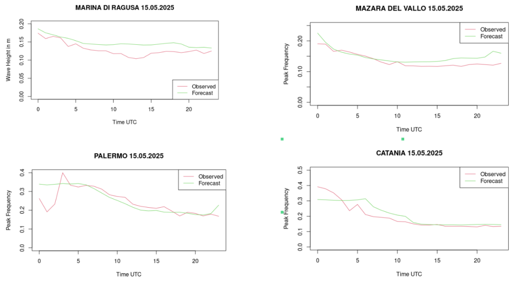
The image represents the result of the performance analysis of the WaveWatch III (WW3) model during the Ines storm. To
verify the validity of the model used, it is essential to compare the data predicted by the model (green curve) with the
data observed (red curve) by the buoys of the National Wave Measurement Network (RON). The figures and statistical
indices compare three key variables: the Significant Wave Height, the Mean Wave Direction, and the Frequency.
The key result is the visual coherence between the two lines: the model's predictions for wave height and direction were
in line with the measurements. Statistical calculations confirm this: the correlation index (r) for significant wave
height was very high (for example, r=0.956 in Catania and r=0.940 in Palermo), proving that WW3 was able to
realistically describe the evolution of the sea state during the storm.
Storm Ines (a strong Mediterranean cyclone, anomalous for the season) struck Sicily on May 15, 2025, bringing intense
rainfall (up to 80 mm) and 2-meter high waves along the southwestern coasts. This event served as a test case for an
advanced forecasting system implemented by the University of Messina, which couples two fundamental models: the Weather
Research and Forecast (WRF) (atmospheric model) and the WW3 (marine model).
WW3 is an advanced model that focuses solely on waves. To function, it requires wind data produced by WRF, so it can
calculate how that energy is transferred to the water to generate waves, how they propagate, and how they lose strength
(dissipation). It is configured with high resolution across multiple specific domains for the Mediterranean.
In the case study examined, WRF (a sophisticated atmospheric weather simulator) satisfactorily predicted the spatial
distribution of rainfall, correctly capturing the maximum values (such as those over central-western Sicily). Despite
some small differences in intensity (locally overestimated or underestimated rainfall), the overall results were deemed
reliable.
The combined use of WRF and WW3 is crucial: the wind from WRF feeds WW3. Validation with Storm Ines confirmed that this
integrated modeling chain is robust and capable of consistently reproducing the atmosphere-sea interaction. This is
essential for Civil Protection and risk management, especially considering that intense phenomena like Medicanes
(Mediterranean cyclones) are becoming more frequent even in atypical seasons, due to warming waters.
___
Adila Sturniolo, Agostino Semprebello, Maria Teresa Caccamo, Salvatore Magazù
References
Gaertner, Mi., et al. (2018). “Simulation of medicanes over the Mediterranean Sea in a regional climate model
ensemble”,
Climate Dynamics, 51.
Colombo, F. et al. (2017). “Un modello ad area limitata per la Sicilia: il WRF dell’Università di Messina”,
Rivista di
meteorologia Aeronautica, 3, pp.5-23.
Tolman, H., et al. (2019). User manual and system documentation of WAVEWATCH III ®, version 6.07.
___
___