Geodetic operations in the Real Gabinetto Fisico
Since the beginning of its observational and data collection activities in 1840, the
Royal Physics Cabinet played a
leading role in the field of geodesy and topography, giving a well defined contribution
to the geodetic survey campaigns
in the Kingdom of the Two Sicilies providing both instruments and expertise.
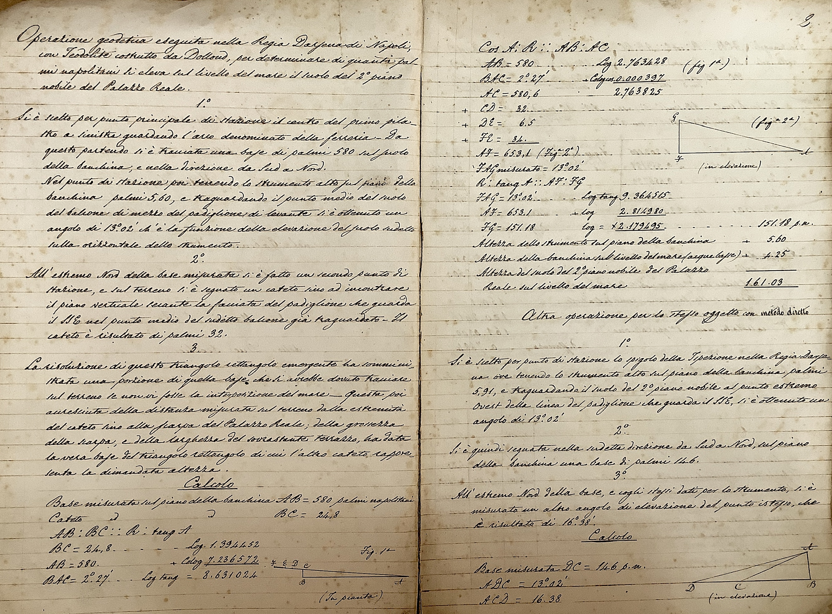
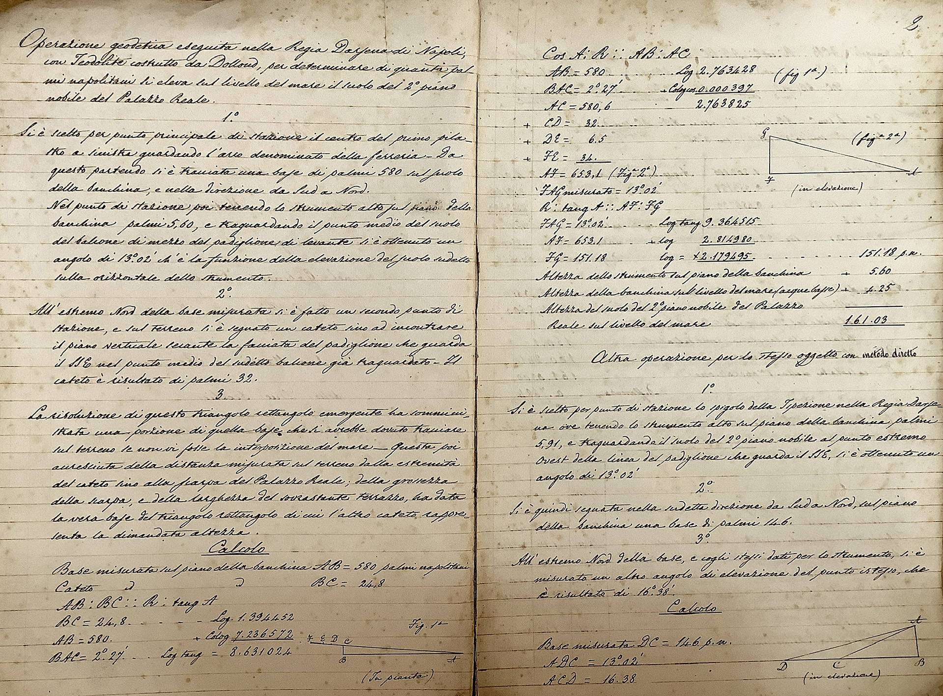
Geodetic operations were carried out in different places in Naples, such as the Shipyard
and the Cavallerizze ramps, by
using the following instruments: Dollond’s Thedolite, Troughton’s sextant, Giuseppe
Spano’s diopter, Schmalcalder’s
azimuth compass, and Gambey’s intensity, inclination and variation compass. Geodetic
operations relied on the
triangulation method, which allowed the calculation of unknown distances through high
precision measurements of given
angles and distances. It was possible to find how many Neapolitan palms the ground of
the second main floor of the Royal
Palace (where the Physics Cabinet was located) rose above the sea level, starting from
the computation of its latitude
and longitude. Furthermore, both the location of the Royal Physics Cabinet and that of
the Royal Astronomical
Observatory in Capodimonte were determined with respect to the location of the Specola
of the Officio Topografico. The
final results were compared with the distances quoted on the city plan of Naples. The
difference in south latitude as
well as west longitude between the Royal Physics Cabinet and the Royal Observatory in
Capodimonte was, then, worked out.
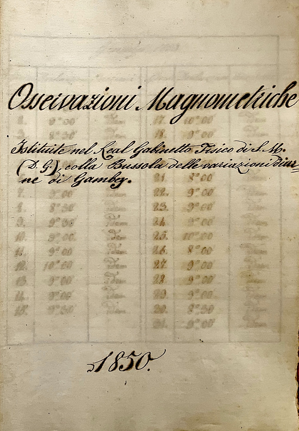
Interesting studies on the terrestrial magnetism were also performed, including
measurements of both Earth’s magnetic
inclination and magnetic declination. Small diurnal fluctuations in the declination of
Earth magnetism were detected as
well (fig. 1), aimed at investigating the interactions between the solar wind and the
Earth’s atmosphere, just when
geophysics was emerging as an independent scientific discipline.
___Salvatore Esposito & Adele
Naddeo
References
Documenti relativi all’attività inerente le osservazioni
meteorologiche, condotte nel Reale
Gabinetto Fisico, Archivio
di Stato di Napoli , Archivio Amministrativo di Casa Reale, Categorie
Diverse, BB. 244, 246, 247, 248.
___
___